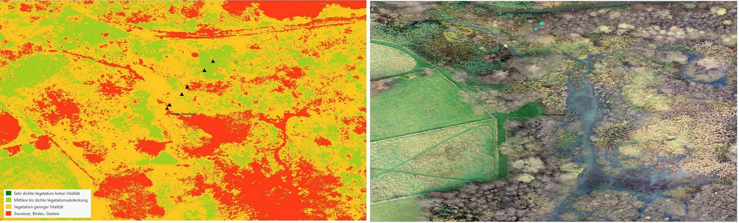
Figure 9:
Assessment and ground-truthing of parts of the working area with a classical vegetation index (NDVI) after indications from satellite imageries - here in October 2021: left NDVI analysis, right RTK orthophoto.