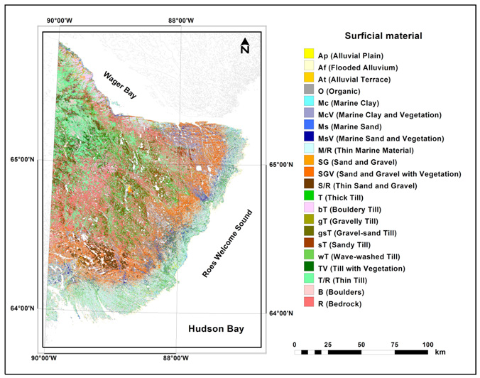
Figure 5:
Remote predictive surficial material map for the southern Wager Bay area, produced by a
Random Forest
classifier applied to a combination of Landsat-8, RADARSAT-2 (HH and HV), DEM and slope data using the
All-polygon
script.