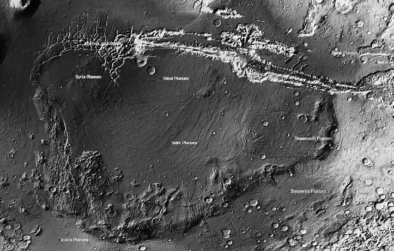
Figure 1: Topographic image map of the Thaumasian region (based on MOLA elevation data) illustrating: (a) The rim highlands (swells and arcuate mountain belts) and Valles Marineris, and (b) the back-arc lowlands (lava plains inside the arcs). Two orogenic arcs are visible: the E-vergent “Coprates Minor Arc” and the SE- to W-vergent “Thaumasia-Claritas Great Arc” (outlined by a dotted line).